3 minutes and 20 seconds

It is defined as one of the most severe blizzards recent years in New York State; But it’s the entire Great Lakes region that’s grappling with heavy, record-breaking snowfall. The weather warning is in effect for more than 6 million people in six Great Lake states: Wisconsin, Michigan, Indiana, Ohio, Pennsylvania and New York.
This dynamism is the result of the massive discontinuity of cold air Affecting much of North America through Texas and Mexico. Images arriving from the affected area show cars and towns buried in the snow; In Orchard Park, the snow cover reached 195 cm, which is a record for snowfall in 24 hours. However, notable accumulations were recorded in Hamburg (187 cm) and Blasdel (180 cm). Buffalo Airport with 43cm of snow falling in 24 hours broke the previous daily record from November 2014 of 20cm. In 2014, snowfall in the city was much higher and is reported as one of the worst snowfalls on record.
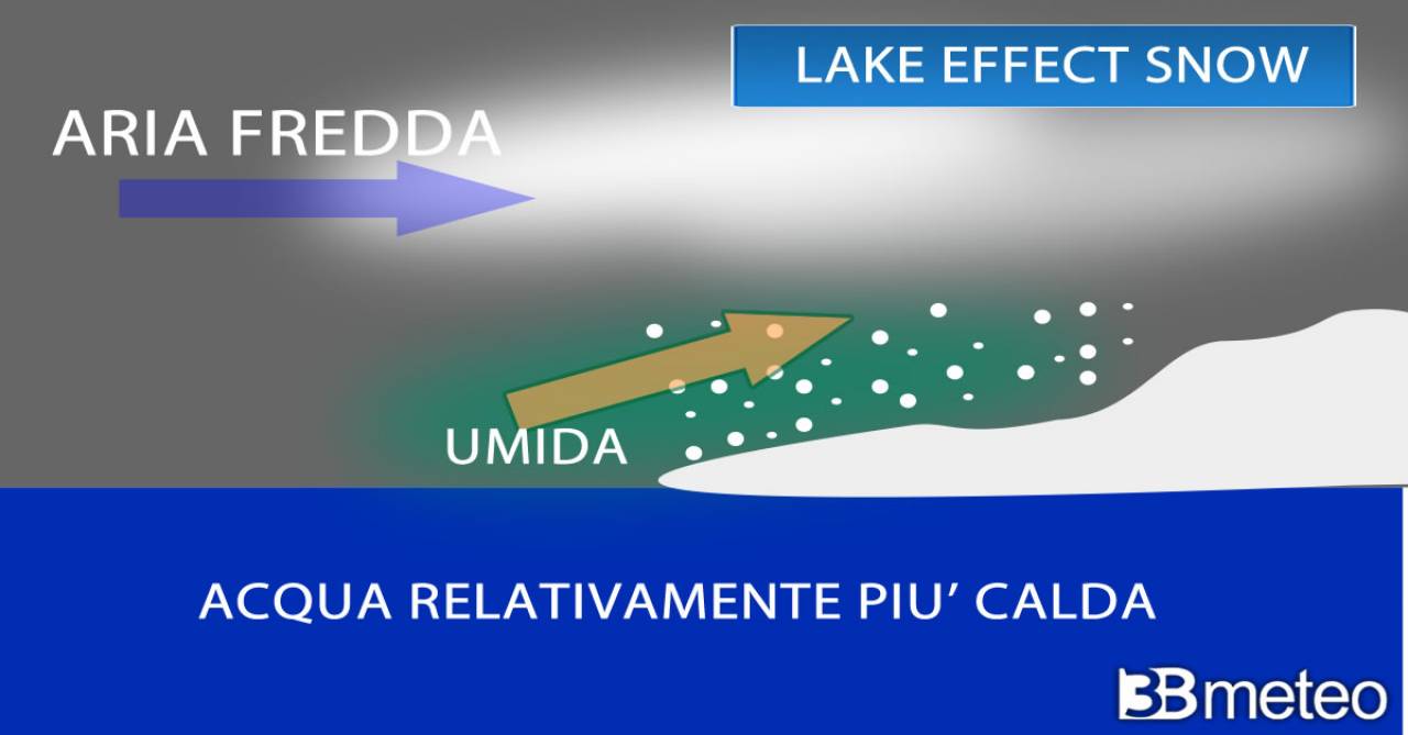
This area is known for heavy snowfall around the time Lake Effect Snow develops. In fact, cold air from Canada flows over the relatively warmer moisture-laden lake waters, creating clouds and precipitation. The most consistent precipitation occurs in contact with the mainland due to the friction created by the terrain on the winds. The greatest precipitation occurs near the hills. Major lake effect snow blizzards occur between late fall and early winter when the air and water temperature difference is greatest, the lakes are not frozen and so there is more moisture. The necessary components for snowfall are: a large vertical temperature gradient, moderate atmospheric instability, moist air at low to mid-latitudes from the west/southwest and relatively warm lake water temperatures. Wind direction is very important because the westerly the wind, the greater the extent of the lake it crosses, and thus the air mass becomes moisture-laden. Wind direction also determines which areas will receive snow so sometimes some points can receive a lot of snow and adjacent locations little or even none. These types of phenomena also occur in other parts of the world such as Scandinavia and Japan.
Numerical models predict more snow for the ‘lake effect’ As the region warms, the ice cover decreases. Greater evaporation could actually lead to more precipitation in nearby areas. Years with less ice cover than normal seem to have become more frequent over the past two decades, especially in Lakes Erie and Superior. Since 1973, the number of freeze days (duration) has decreased in all five Great Lakes; The Great Lakes remain frozen 8 to 46 fewer days than they were in the early 1970s. The declines in Lakes Ontario and Lake Superior are also statistically significant.
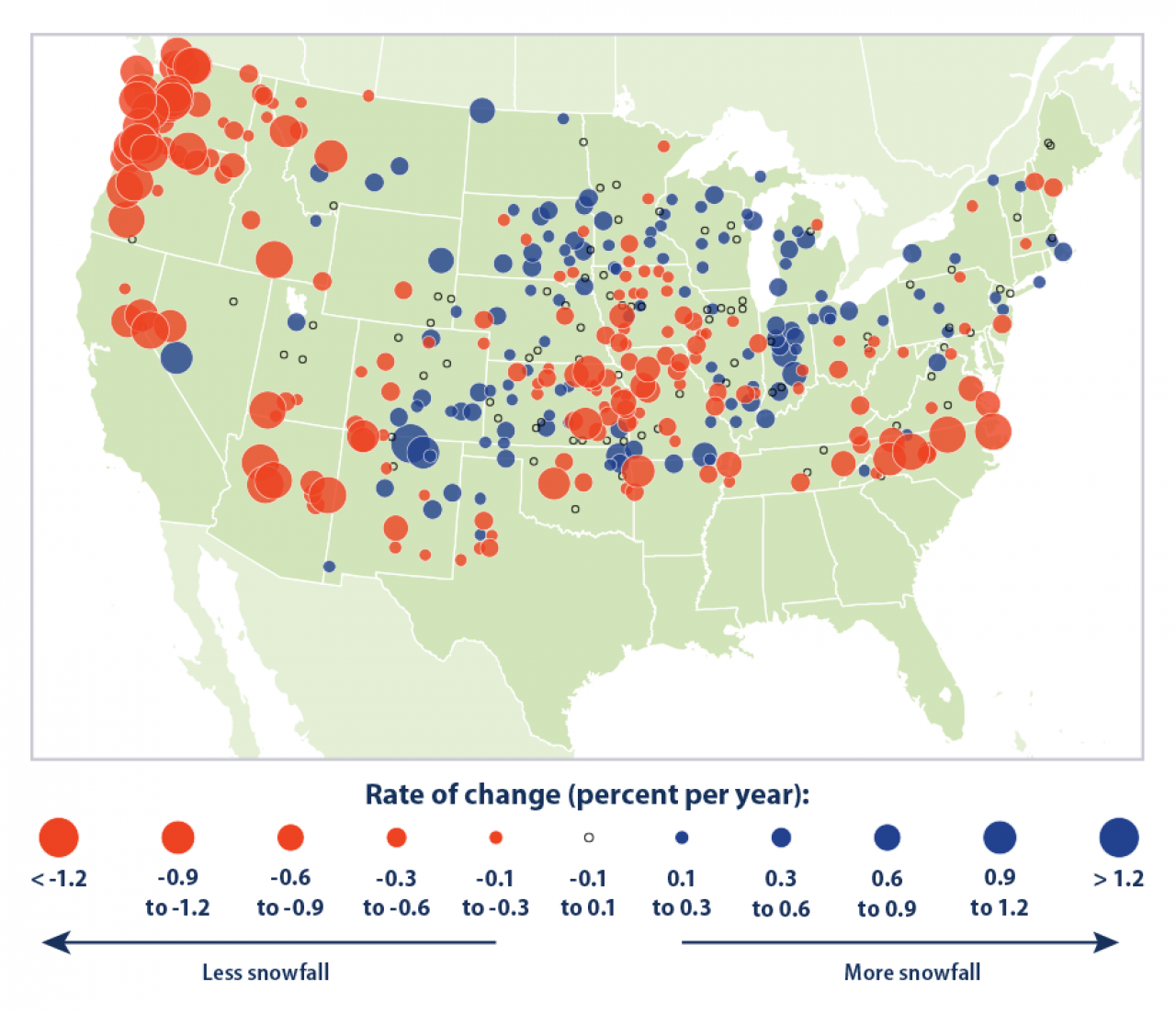
In 2009 work by Kunkel et al, total snowfall has decreased in many parts of the USA. The Pacific Northwest has seen a decrease in both total snowfall and the proportion of precipitation that falls as snow. Parts of the Midwest also experienced a decline while the Great Lakes region experienced an increase. Snowfall can coexist in a warmer world At least until there is enough cool air blowing over the lakes (Burnett et al. 2003, Andresen et al. 2012). Provided, however, that temperatures from greenhouse gases do not continue to rise above a certain threshold, beyond which “lake effect” snow would be less likely to turn into rain.

Follow us on Google News